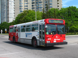
How to Ride a Public Bus in Ottawa

Ottawa’s public transportation service, the OC Transpo, is a fantastic way to get around the city. The combinaton bus and train service covers an area as far east as Orleans and Vars to as far west as Manotick and Barrhaven. Some buses even travel across the river to Gatineau, Quebec where the local bus service, the STO runs in concert with OC Transpo service.
In many cases, taking the bus is the fastest means of transportation around the Ottawa area. A network of streets and passageways that connect the city from one end to the other known as the Transitway is available exclusively to OC Transpo buses and emergency vehicles. This enables buses to avoid usual traffic delays and rush hour.
The bus service is supported by a 5 stop train system known as the O-Train. O-Train stations integrate seamlessly with bus stations, allowing travelers to move easily between the two.
Services are also offered for people with physical disabilities and people with impaired disabilities. Bike racks are available on many bikes.
Below is a step by step guide on how to use the bus service effectively.
Instructions
-
1
Find a Sales and Information Centre
The OC Transpo has several sales and information locations available to serve travelers. These locations have helpful staff, maps for each bus route including schedules, and sell tickets and passes. The sales and information centres are:
The Rideau Centre
St. Laurent Mall
Lincoln Fields
Place D'Orleans
For more information on these locations click here.
The website is also extremely useful and contains all of the information one would require including routes, fares, contact details, ticket sale locations and news regarding delays and changes.
-
2
Get Route Information
There are several ways to get route information for the Ottawa bus system. One may call transit information, visit a sales and information centre or better yet visit the website. Route information, maps and schedules are available here. Different types of routes have different fares, be sure to confirm this in accordance with your travels.
The website has an extra valuable tool known as the Travel Planner that allows you to plan a trip using the start point, end point and time of day. This tool gives you step by step instructions including walking directions, estimated wait times and travel time. The Advanced Travel Planner can be found here.
From - You begin planning by entering your starting point. The information you enter can be either a street address, main intersection, landmark , specific bus stop (by number on sign) or geographic area. Select the one that best pertains to your location.
To - The second step of travel planning involves entering your destination information. Once again you may enter a street address, main intersection, landmark , specific bus stop (by number on sign) or geographic area.
Time - This feature allows you to select the date as well as time you wish to travel. You are able to select a time based either on when you must leave or when you must arrive.
If you need to take the O-Train, visit the website.
-
3
Pay the Fare or Buy Tickets
Bus far can be paid in cash (exact value only), tickets, a combination of both, and by purchasing a pass. Fares vary based on age and other factors. Visually impaired travelers are exempt from paying any fares. For senior rates are discounted. For complete fare details click here.
Tickets and passes can be purchased at many different locations around the city including:
You can search to find the vendor closest to you here.
NOTE: O-Train tickets differ in price from bus tickets and can only be purchased at O-Train stations.
-
4
Take the Bus
Once you have determined where you want to go, the best way to get there, the timings involved and gathered the appropriate fare cost/ticket all that is left is to enjoy your travel experience.


