How to Get Directions on an Android

One of the most useful features in a smart-phone is the ability to use digital maps and navigation aids. Nearly all smart-phones today come with built-in navigation apps, which can be supplemented by 3rd party tools. If you have an Android based phone however, you are in luck, because the operating system’s developer, Google, also happens to have the world’s leading mapping service, Google Maps. This app is pre-installed in nearly every Android based phone and provides high-resolution satellite imagery along with street maps and navigation (currently in beta and not available in all countries). If you own a high-end Android phone, you can benefit from a built-in GPS receiver, which uses satellites to determine your location, supplementing the mapping app. However, even if your phone does not have a GPS receiver, Google Maps will use information from your cellular and nearby Wi-Fi networks to triangulate your position, though not as accurately.
Instructions
-
1
If your phone has Google Maps pre-installed, you can find it in the app drawer, placed as a map icon, conveniently named ‘Maps’. However, if you cannot find it installed, you will need to open up the ‘Play Store’ and search for ‘Google Maps’ before downloading and installing it.
-
2
Once you have located or installed the app run it. Once the app starts, it will present you with a dialogue box titled ‘Improve location accuracy, and will ask you to switch on Wi-Fi, mobile networks and GPS. Tap the ‘Settings’ button at the bottom of the dialogue box.
-
3
After tapping the settings button, you will be taken to the ‘Location services’ page, where you can check boxes next to ‘Use wireless networks’ and ‘Use GPS satellites’. Once you have selected these options, press the ‘back’ key on your phone to return to the mapping app.
-
4
Once back in the mapping app, you should see a blinking GPS icon in the status bar which means your device’s GPS receiver is trying to connect to satellites. When the icon stops blinking, the mapping app will point out your location on the map with a blue dot.
-
5
Now you need to tap the search button (magnifying glass icon) at the bottom of the app and enter your destination in the new dialogue box. The mapping app will search for your query and present you with matching results which you can select.
-
6
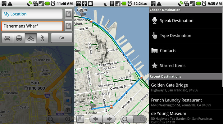
Once you have selected your destination, the dialogue box will also have a second option for your starting point, which by default is your current location. Once you have selected your starting point and destination, tap the ‘Get directions’ option on the dialogue box (you can further choose to get directions by car, on foot etc, but these are available in limited locations).
-
7
The mapping app will use your data connection or Wi-Fi to generate directions to your destination. The path will be highlighted and estimated time provided.


